BRAILS
The BRAILS tab provides an automated workflow for coupling Celeris with
BRAILS building inventories and NOAA topo-bathymetry data.
It streamlines the preparation of simulation inputs by:
Acquiring topo-bathymetry from NOAA APIs automatically.
Generating and merging BRAILS building inventories.
Performing imputation to fill missing building attributes.
Combining building data with bathymetry-topography to form the input bathymetry file for the simulation.
Important
This tool directly updates the input files in the Celeris tab.
Once the workflow finishes, the bathymetry visualization will also refresh
with the new inputs.
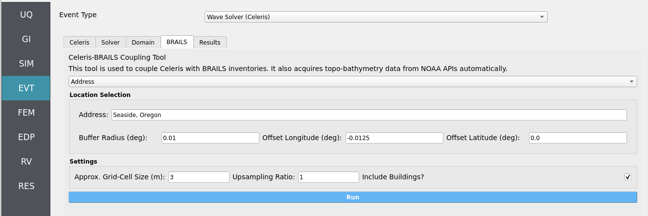
Location Selection
At the top of the tab, the Location Selection widget provides two methods for defining the region of interest.
Option 1: Address (Easy / Recommended)
Enter a text address (e.g., “Seattle, WA”).
The tool automatically geocodes this to latitude/longitude.
Specify:
Buffer Radius (degrees): defines the square region size.
Offset Longitude / Latitude (degrees): shifts the centroid if needed.
Note
This approach is easiest since it uses a human-readable address with optional adjustments.
Option 2: Bounding Box (Precise)
Manually specify:
lon_LLandlat_LL= lower-left cornerlon_URandlat_UR= upper-right corner
Retrieves BRAILS inventories and NOAA bathymetry within the bounding box.
Tip
Use the bounding box if you require fine-grained control of the study area.
Settings Widget
At the bottom of the tab, the Settings widget allows fine control of bathymetry grid preparation:
Approx. Grid-Cell Size (m): NOAA API attempts to match this resolution, with slight warping due to global projections.
Upsampling Ratio: -
1= no upsampling -2= doubles the resolution - Higher values increase detail, but also computational cost.Include Buildings?: - Checked = merge BRAILS building inventory with topo-bathymetry. - Unchecked = skip buildings for faster runs (minutes saved), but lose
built-environment effects.
Warning
Excluding buildings speeds up the workflow but removes their influence on hydrodynamics in your Celeris simulations.
Run Workflow
At the bottom, press the Run widget to execute the automated workflow.
Workflow sequence:
Acquire topo-bathymetry from NOAA APIs.
Generate and merge BRAILS inventories.
Perform imputation for missing attributes.
Combine inventories with bathymetry to form simulation-ready input files.
Update the Celeris tab automatically: - Input bathymetry file - Visualization of bathymetry, sensors, and structures
Note
Always verify the updated inputs in the Celeris tab before launching
full simulations.