3.3. Hazard Characterization
This testbed considers the wind hazard and its effect on the building inventory. The National Institute of Standards and Technology (NIST), in collaboration with Applied Research Associates, Inc. (ARA), has developed a rapid response estimate of the surface-level wind field for Hurricane Laura in support of a Mission Assignment from FEMA. The wind field, depicted in Fig. 3.3.11, was produced on September 4, 2020, and is available for download from DesignSafe. It incorporates storm track and central pressure data from the National Hurricane Center through Forecast Advisory Number 33 and observations through 1200 UTC on 08/28/2020. The wind hazard is quantified by the peak 3-second gust measured at \(10m\) height under open terrain conditions.
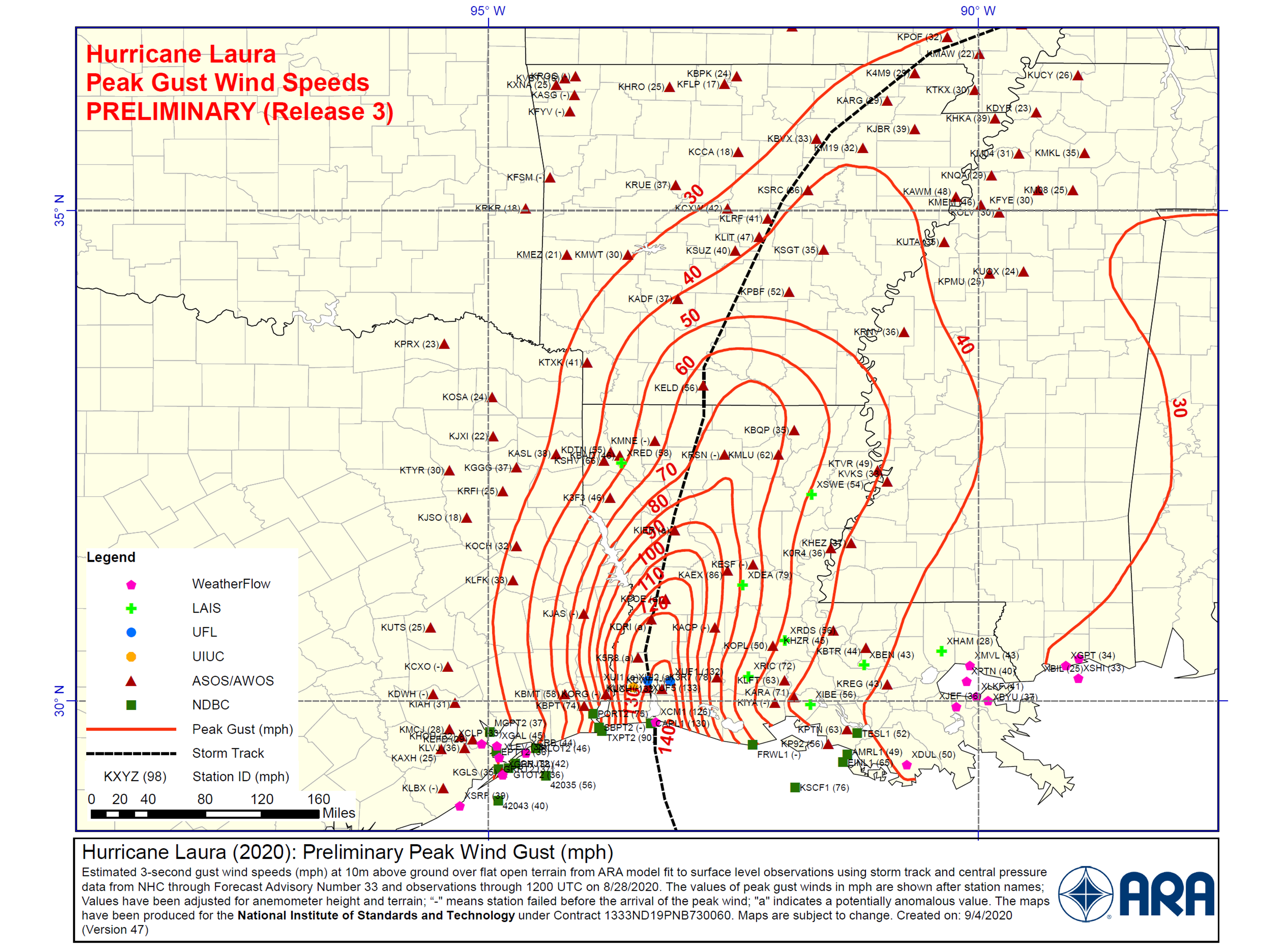
Fig. 3.3.11 Peak wind speeds generated by ARA, Release 3 (3s-gust at 10 m in open terrain).
In Lake Charles, the ARA wind field is first mapped to a rectangular grid with 0.01 to 0.02 degree intervals. The peak wind speed at each building site is then randomly sampled from its nearest four neighboring grid points. Fig. 3.3.12 shows the averaged peak wind speed from 1000 random samples for each building site in our area of interest. The wind speed is relatively stable in the region, ranging from \(131 mph\) to \(135 mph\).
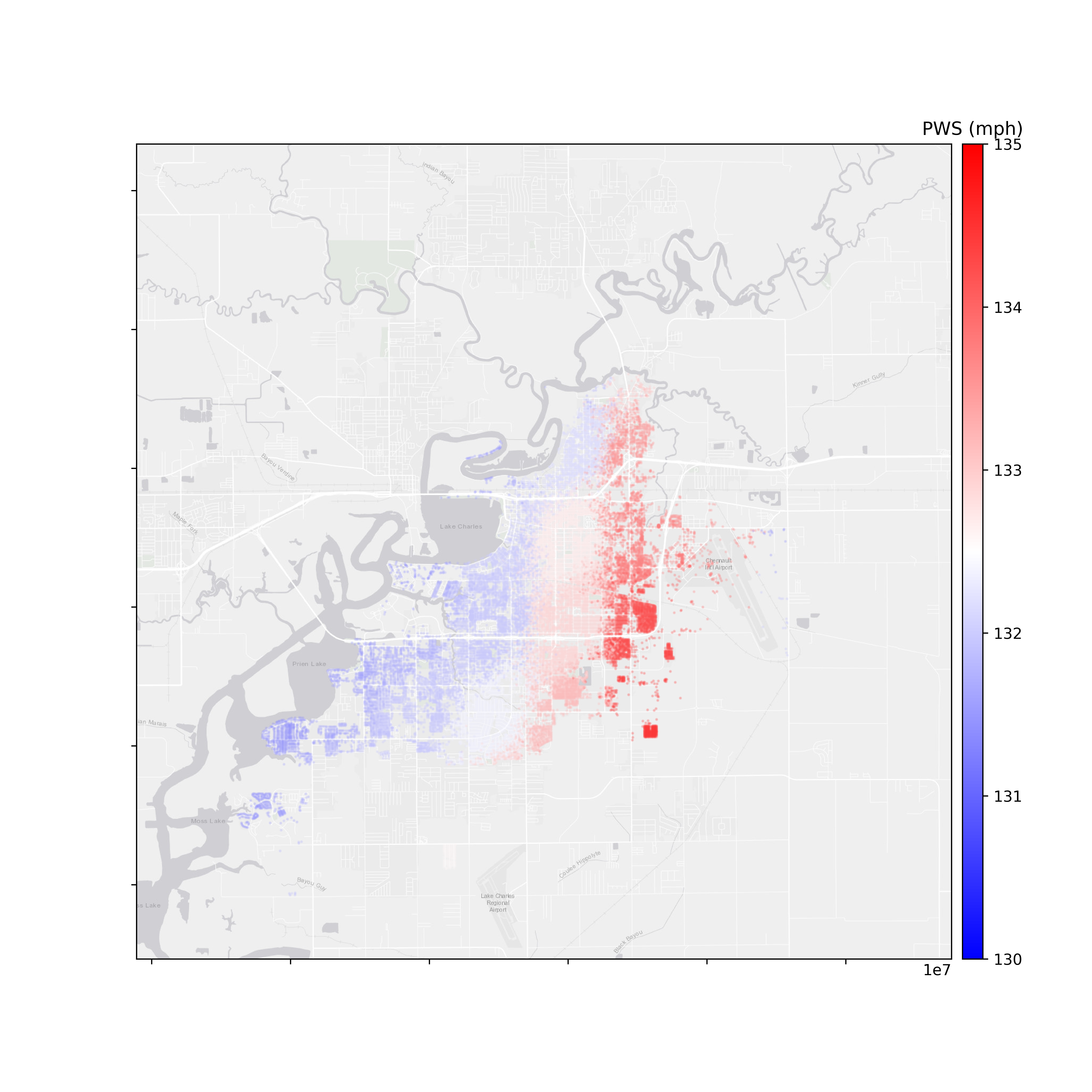
Fig. 3.3.12 Peak wind speeds interpolated to footprint locations of building inventory.
Users can access the interpolated wind field inputs for the defined scenario via Table 3.3.1.
Hazard |
Access Point |
|---|---|
Wind Field |